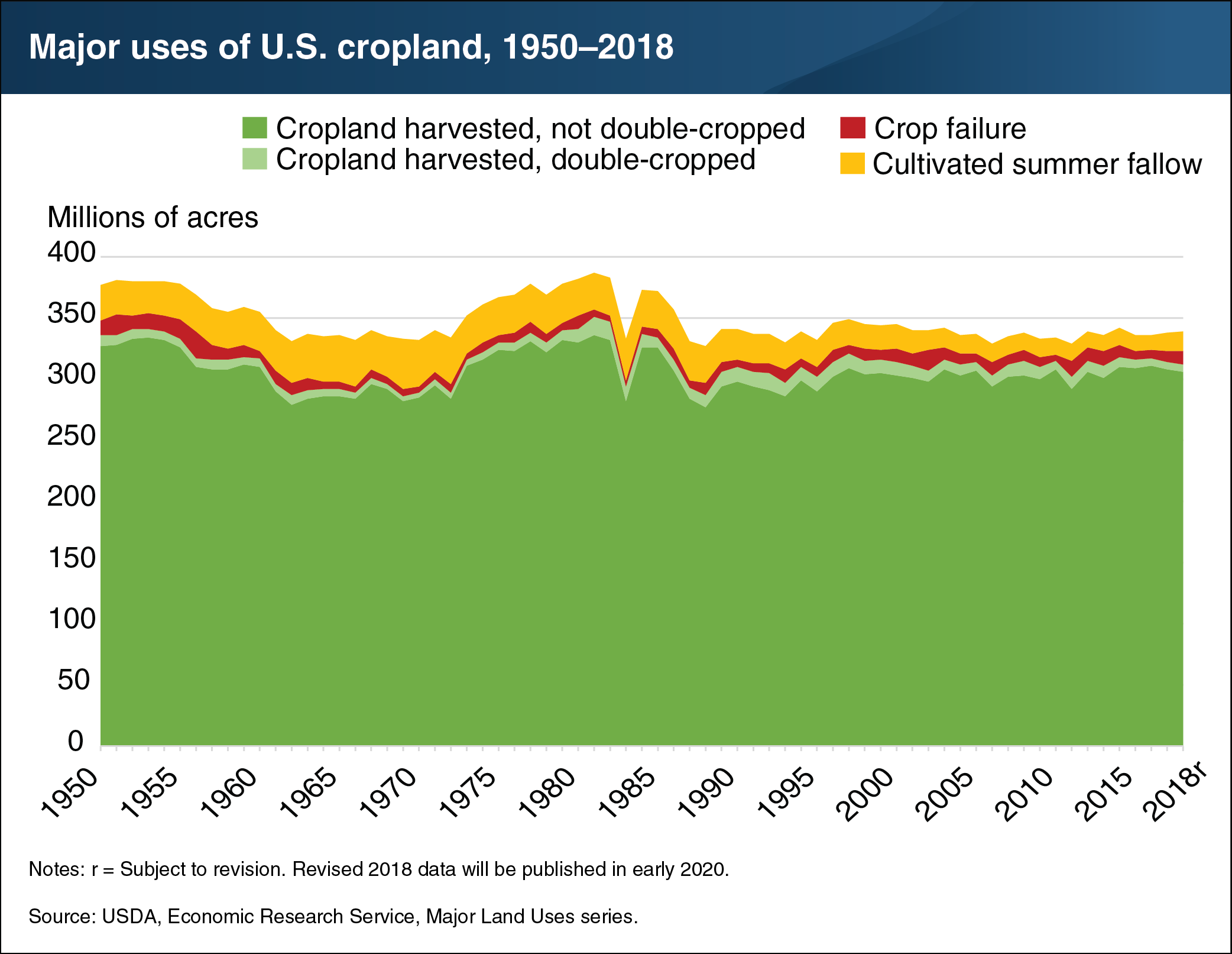
Harvested cropland declined by 2 million acres in 2018, coinciding with a rise in crop failure
- by Daniel Bigelow
- 6/7/2019

The ERS Major Land Uses series defines “cropland used for crops” as comprising three types: cropland harvested, crop failure, and cultivated summer fallow. In 2018, cropland harvested declined to 312 million acres—the lowest recorded harvested cropland area since 2013 (311 million acres) and 2 million acres less than in 2017. A 2-million-acre increase in crop failure due to drought conditions in several crop-producing areas contributed to the 2018 decline in cropland harvested. Land used for cultivated summer fallow, which primarily occurs as part of wheat rotations in the semi-arid West, also increased by 1 million acres to 16 million acres, continuing the reversal, which began in 2017, of a long-term decline in this category. The area that was double-cropped (i.e., two or more crops harvested) held constant over the previous year at about 6 million acres. This chart uses historical data from the ERS data product Major Land Uses, recently updated to include new 2018 estimates and revised 2017 estimates.


