
Land in active crop production dips in 2015
- by Daniel Bigelow
- 4/12/2016
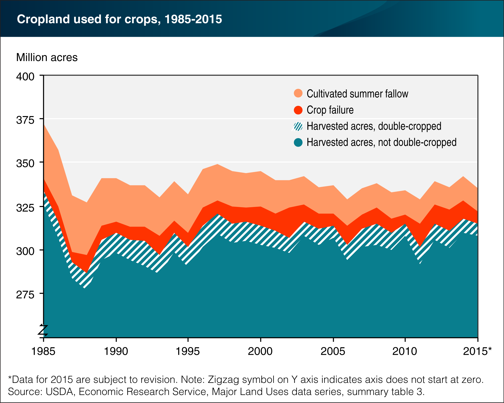
The ERS Major Land Uses (MLU) data series provides a snapshot of land use across the United States. While much of the MLU series is updated roughly every 5 years, cropland used for crops, the category representing the acres of land in active crop production, is updated on an annual basis. Cropland used for crops has three main components: cropland harvested (including acreage double-cropped), crop failure, and cultivated summer fallow. In 2015 (the most recent estimate), the total area of cropland used for crops in the United States was 335 million acres, down 6 million acres from the 2014 estimate and about 5 percent below the 30-year average. In 2015, cropland harvested declined by 1 percent (3 million acres) over the previous year. The area that was double-cropped—land from which two or more crops were harvested—declined by 1 million acres, a 13-percent decline from the 2014 double-cropped area of 8 million acres. Acres on which crops failed declined by 30 percent over the past year to 7 million acres, the lowest level since 2010. This chart is based on ERS’s Major Land Uses, summary table 3: Cropland used for crops, updated March 25, 2016.
We’d welcome your feedback!
Would you be willing to answer a few quick questions about your experience?