
Large share of Conservation Reserve Program enrolled land concentrated across the central part of the country
- by Bryan Pratt
- 10/21/2024
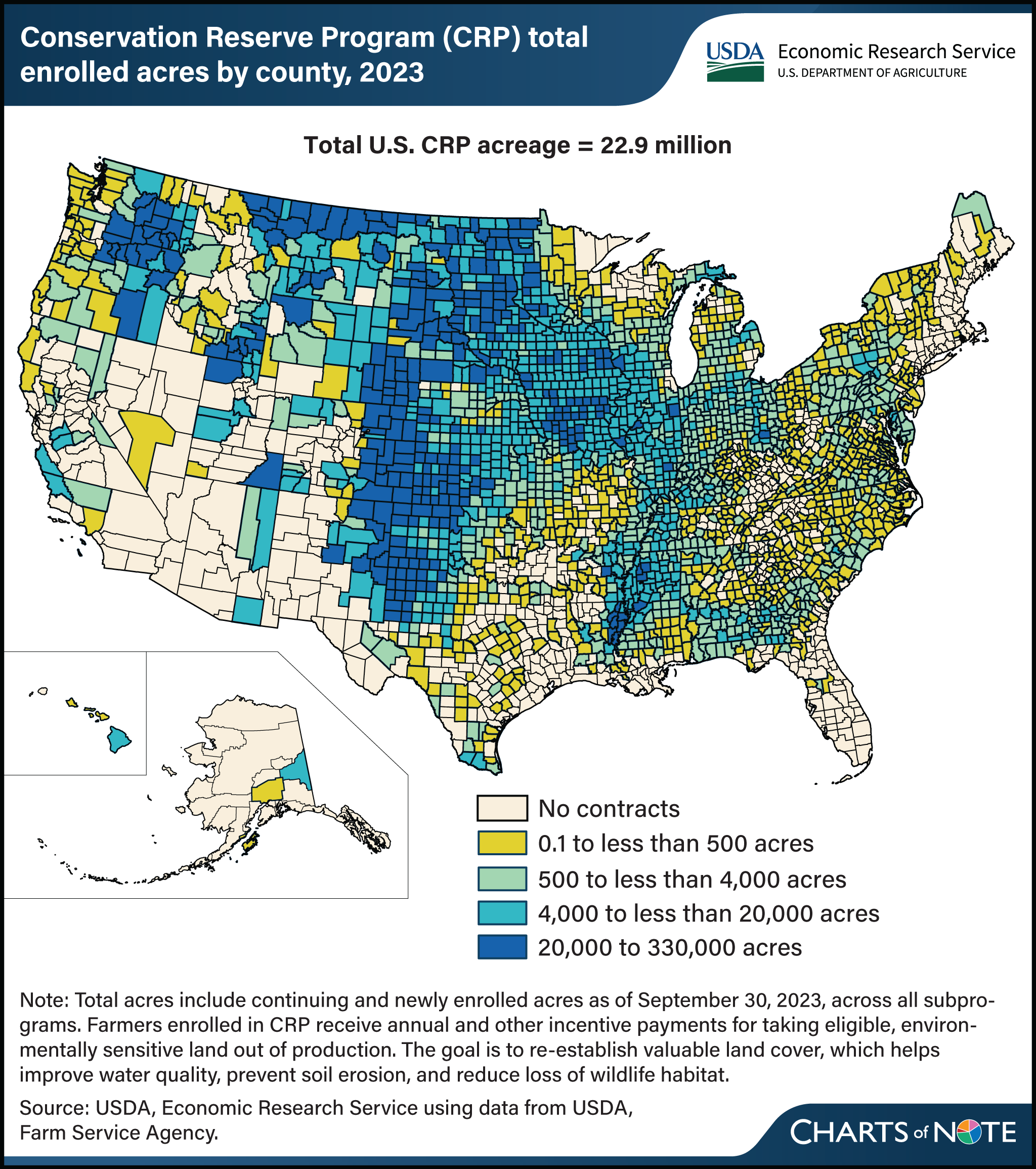
USDA’s Conservation Reserve Program (CRP) covered about 22.9 million acres of environmentally sensitive land at the end of fiscal year 2023, with an annual budget of roughly $1.8 billion. This made CRP the largest single USDA conservation program in terms of spending that year. Through CRP, enrollees receive annual and other incentive payments for taking eligible, environmentally sensitive land out of production for 10 to 15 years. Program acreage tends to be concentrated on marginally productive cropland that is susceptible to erosion by wind or rainfall. The program is administered by the Farm Service Agency with a goal of re-establishing valuable land cover, which helps improve water quality, prevent soil erosion, and reduce loss of wildlife habitat. A large share of land is enrolled in CRP from Texas to Montana and North Dakota across the Great Plains, where rainfall is limited and much of the land is subject to potentially severe wind erosion. Smaller concentrations of CRP land are found in eastern Washington; southern Iowa; northern Missouri; along the Mississippi River in Arkansas, Louisiana and Mississippi; southeastern Idaho; and northwestern Utah. This map is found in the USDA, Economic Research Service data product Ag and Food Statistics: Charting the Essentials.