
Wind energy development varies by region
- by Karen Maguire, Sophia Tanner and Justin B. Winikoff
- 5/29/2024
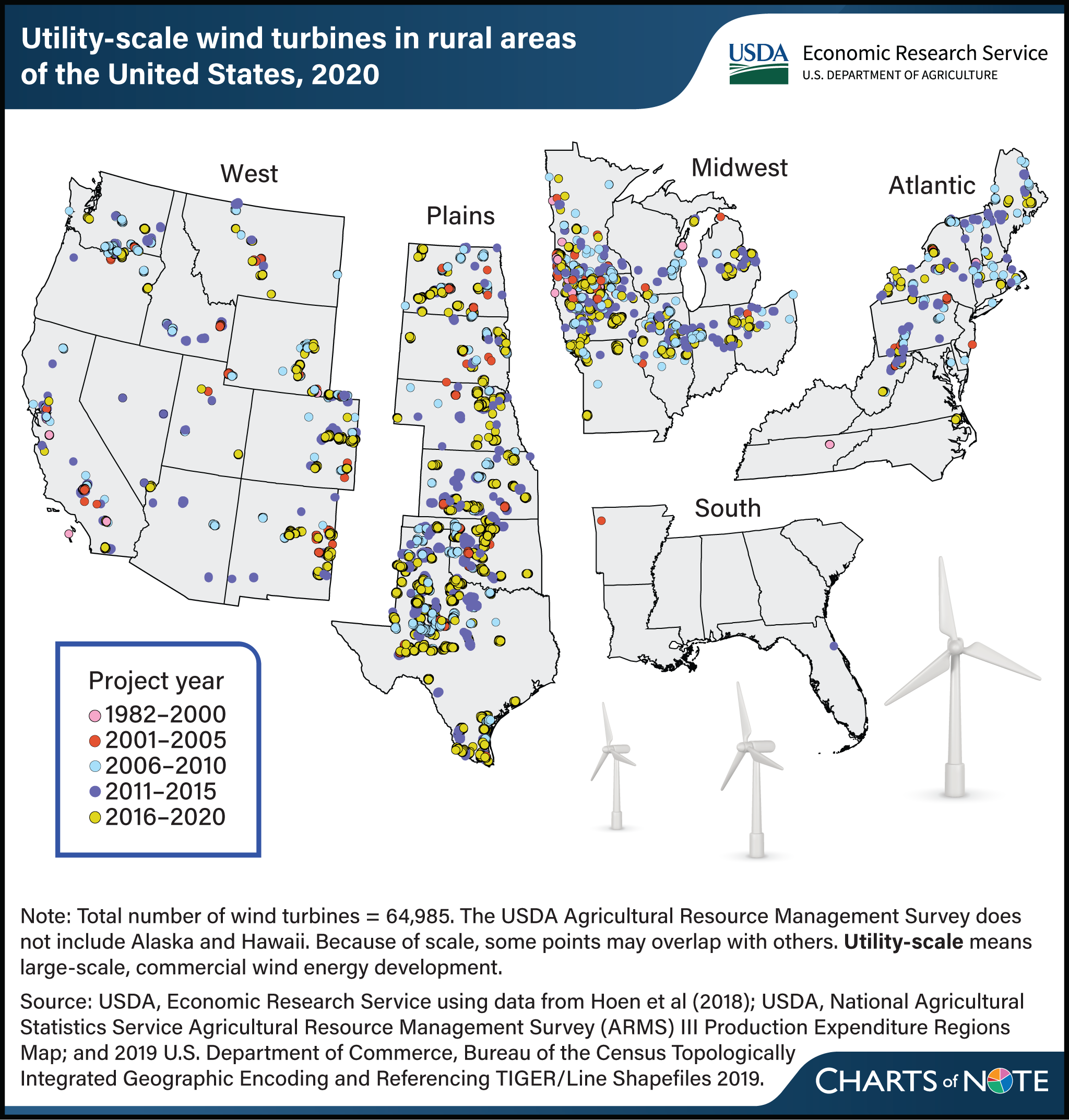
As of 2020, large-scale, commercial wind energy development in the contiguous United States has been concentrated in areas with consistent, high wind speeds. Wind turbines are most prominent in the Plains, followed by the Midwest and West. While the regional distribution of wind energy development is influenced by State-level energy policy, one of the most important factors for development is the wind potential in a region. Some regions, such as the South, lack sufficient wind potential for large-scale development. USDA, Economic Research Service (ERS) researchers found that 90 percent of wind turbines in rural areas were installed on agricultural land (crop, pasture, or range land). Because the amount of land cover directly affected by wind turbines was small relative to the amount of farmland, and because farmers and ranchers can typically continue agricultural production near wind turbines after they are installed, land cover changed on only 4.8 percent of sites after installation. Some of this change was from one agricultural use to another, such as from cropland to pasture. The estimated footprint for wind farms was roughly 88,000 acres in 2020. For more about the expansion of wind and solar in rural areas of the contiguous United States, the regional distribution of renewable energy development, and the land cover change associated with development, see the ERS report Utility-Scale Solar and Wind Development in Rural Areas: Land Cover Change (2009–20), released in May 2024.
We’d welcome your feedback!
Would you be willing to answer a few quick questions about your experience?