
USDA’s Conservation Reserve Program is regionally concentrated
- by Daniel Hellerstein
- 12/3/2018
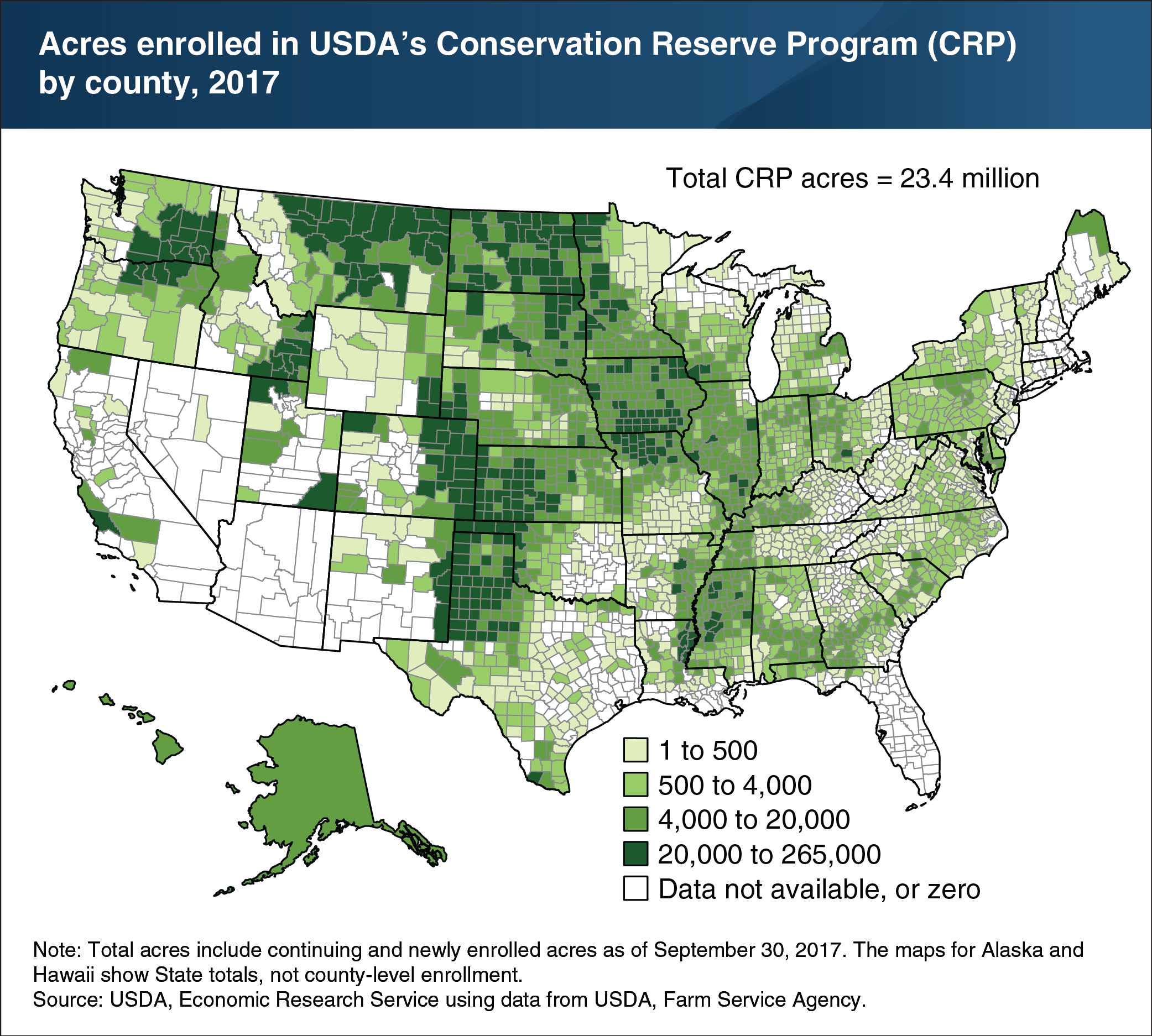
As of the end of fiscal year 2017, USDA’s Conservation Reserve Program (CRP) covered 23.4 million acres of environmentally sensitive land. With an annual budget of $1.8 billion, CRP was USDA’s largest conservation program in terms of spending at that time. Enrollees receive annual rental and other incentive payments for taking eligible land out of production for 10 years or more. Program acreage tends to be concentrated on marginally productive cropland that is susceptible to erosion by wind or rainfall. A large share of CRP acreage is located in the Great Plains (from Texas to Montana), where rainfall is limited and much of the land is subject to potentially severe wind erosion. Smaller concentrations of CRP land are found in eastern Washington, southern Iowa, northern Missouri, southern Idaho, and the Mississippi Delta. This chart appears in the ERS data product Ag and Food Statistics: Charting the Essentials, updated October 2018.