
Guidance systems are used on about half of planted acres for several major crops
- by David Schimmelpfennig
- 10/19/2016
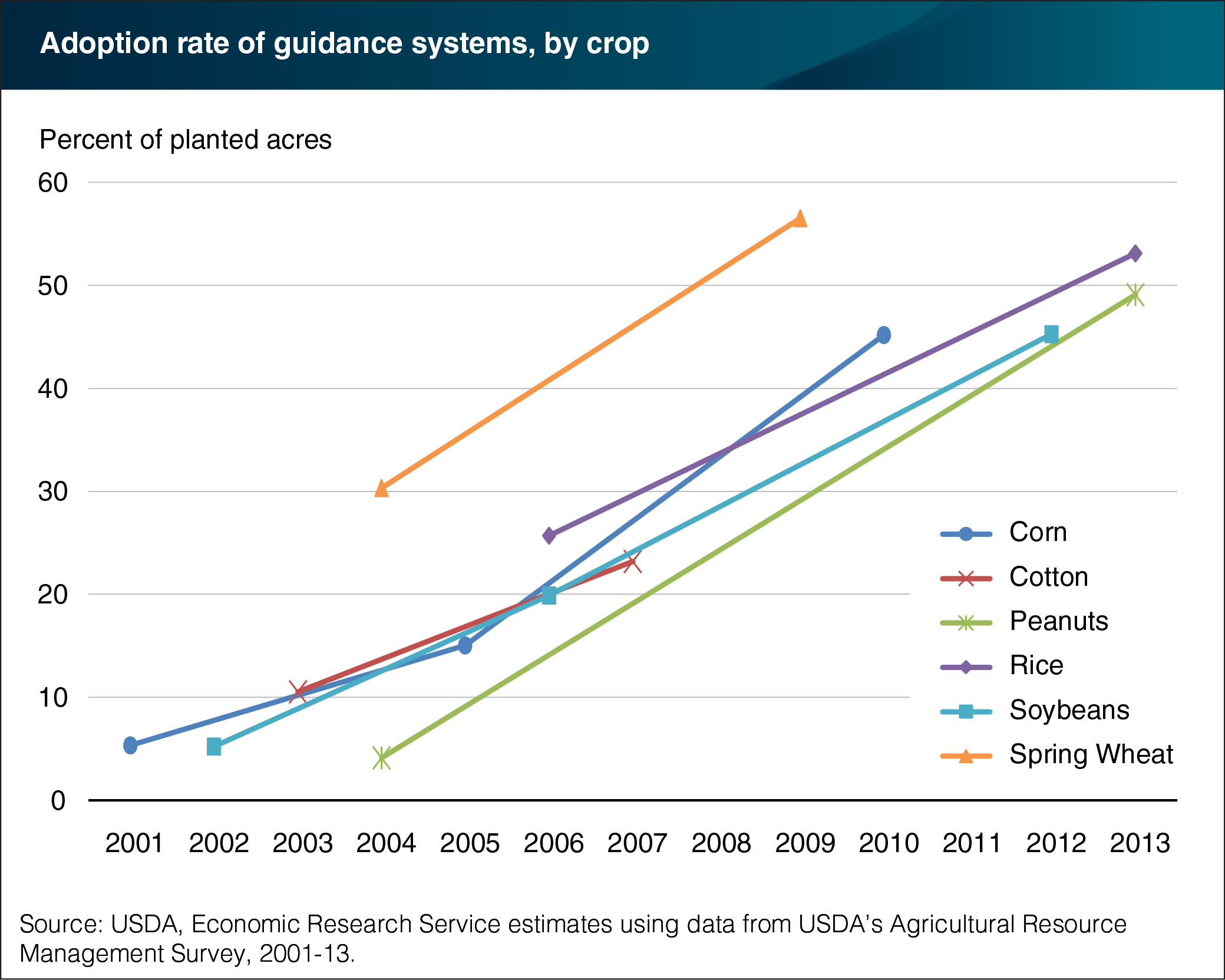
Guidance systems use global positioning system (GPS) coordinates to automatically steer farm equipment like combines, tractors, and self-propelled sprayers. Guidance systems help reduce operator fatigue and pinpoint precise field locations, within a few inches. Freed from steering, operators can access timely coordinates from a screen, monitor other equipment systems more closely, and correct problems more quickly. Guidance systems also reduce costs by improving the precision of sprays and the seeding of field crop rows. Between 2010 and 2013, these systems were adopted on 45 to 55 percent of planted acres for several major crops, including rice, peanuts, and corn. Once adopted for a particular crop, the use of guidance systems tends to be rapidly adopted by other crop farmers. The ease-of-use and functionality of these systems has also increased along with adoption rates. This chart appears in the ERS report Farm Profits and Adoption of Precision Agriculture , released October 18, 2016.
We’d welcome your feedback!
Would you be willing to answer a few quick questions about your experience?