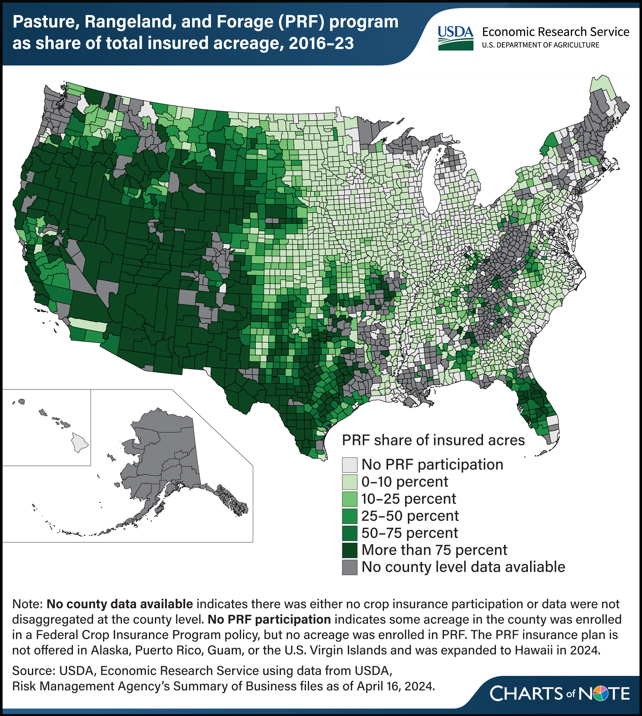
The Pasture, Rangeland, and Forage Insurance Plan represents the majority of insured acreage in the Western United States
- by Dylan Turner
- 1/13/2025

The Pasture, Rangeland, and Forage Insurance Plan, offered as part of the Federal Crop Insurance Program (FCIP), acts as a risk management tool for livestock producers. Under the plan, USDA tracks average precipitation levels within geographic grids and makes payments to enrolled producers within a grid if precipitation drops below historical average levels. The plan’s coverage is intended to protect producers from potential financial losses resulting from a reduction in grazable forage. Introduced as a pilot program in 2007 for select States, the plan was expanded to the entire contiguous United States by 2016. Since then, participation has grown each year, with enrollment rising from 44 million acres in the 2016 crop year to 278 million acres in the 2023 crop year. Enrollment is concentrated in areas with large amounts of forage and grazing land, and for many counties in the Western United States, the forage plan represents a majority of FCIP insured acreage. In more than half of the counties in Arizona, Wyoming, Utah, New Mexico, Nevada, Oregon, Texas, and Idaho, it represents the majority of FCIP participation when measured by insured acreage. Among eastern States, Florida stands out, with the forage plan accounting for the majority of insured acreage in 29 out of 67 counties. This chart first appeared in the USDA, Economic Research Service report Potential Budgetary Impacts of Climate Change on the Pasture, Rangeland, and Forage Insurance Plan, published in December 2024. See also the Amber Waves article Pasture, Rangeland, and Forage Drive Increased Participation in Federal Crop Insurance Program, published in June 2024.

