

GPS guidance systems are used on about half of planted acres for major crops
- by David Schimmelpfennig
- 5/17/2019
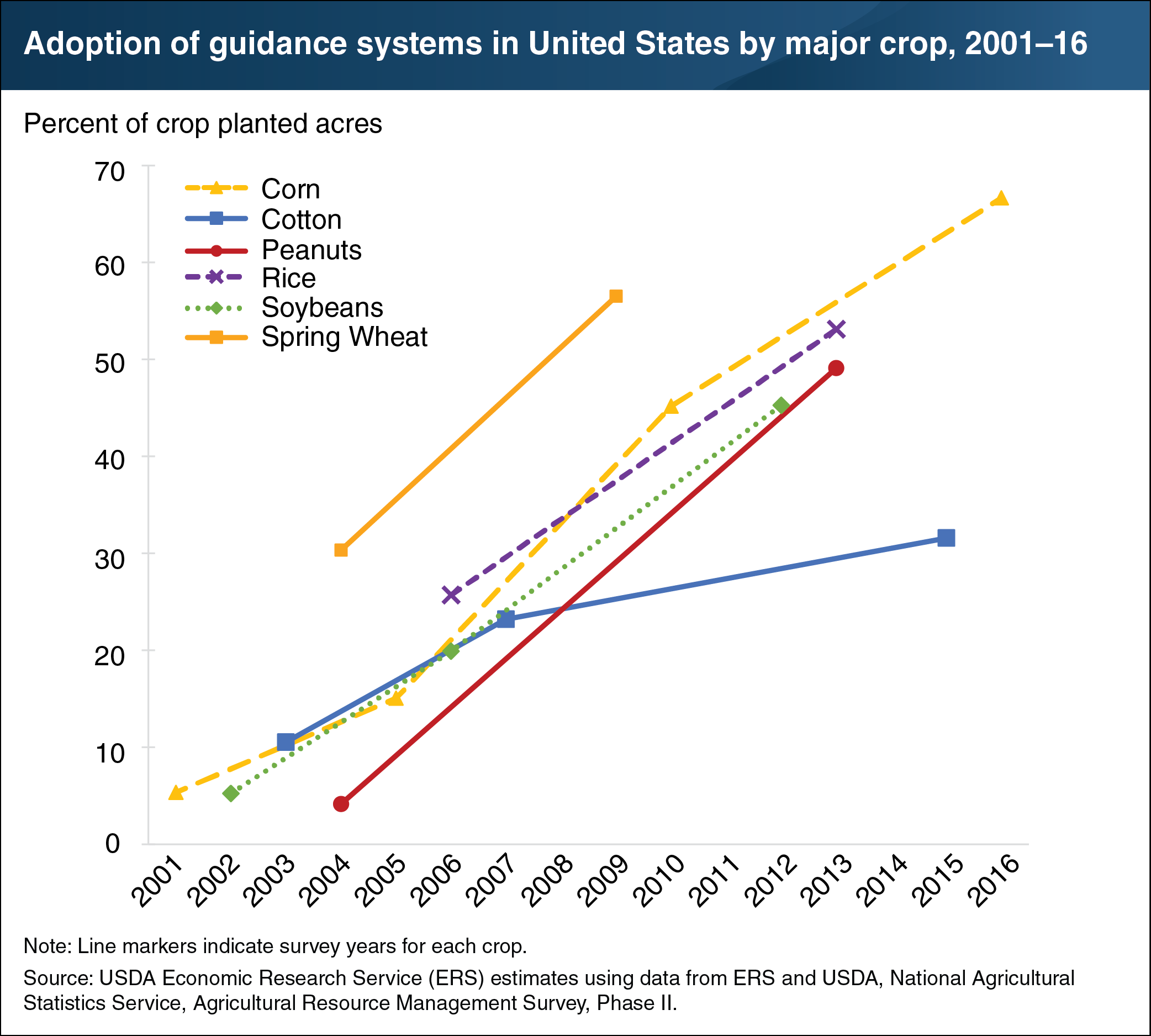
Guidance systems use global positioning system (GPS) coordinates to automatically steer farm equipment like combines, tractors, and self-propelled sprayers. This helps reduce operator fatigue and pinpoint precise field locations within a few inches. Freed from steering, operators can access timely coordinates from a screen, monitor other equipment systems more closely, and correct problems more quickly. In addition, guidance systems reduce costs by improving the precision of sprays and the seeding of field crop rows. The ends of rows, in particular, benefit from more accurate application of inputs. Manually reversing farm machinery to return in the opposite direction in adjacent rows on a field can cause overlaps and missed spots for applied inputs. Guidance systems can also help extend working hours for field operations during time-sensitive production periods because guided machinery works well in the floodlit dark. Out of all precision agriculture technologies, guidance systems had the highest adoption rates—used on 67 percent of corn planted acres (in 2016), 57 percent of spring wheat (2009), 53 percent of rice (2013), 49 percent of peanuts (2013), and 45 percent of soybeans (2012). This chart appears in the May 2019 ERS report, Agricultural Resources and Environmental Indicators, 2019.