



Map 1: Higher shares of total cropland designated as base acreage indicate where land may be constrained ; Map 2: Fruit and vegetable area planted comprises a large share of nonbase cropland in some regions.
- by Edwin Young
- 1/23/2014
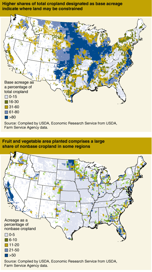
Map 1: Higher shares of total cropland designated as base acreage indicate where land may be constrained ; Map 2: Fruit and vegetable area planted comprises a large share of nonbase cropland in some regions.
We’d welcome your feedback!
Would you be willing to answer a few quick questions about your experience?