
Use of surface or groundwater for irrigation depends on regional water availability, legal institutions, and infrastructure investments
- by R. Aaron Hrozencik
- 3/14/2022
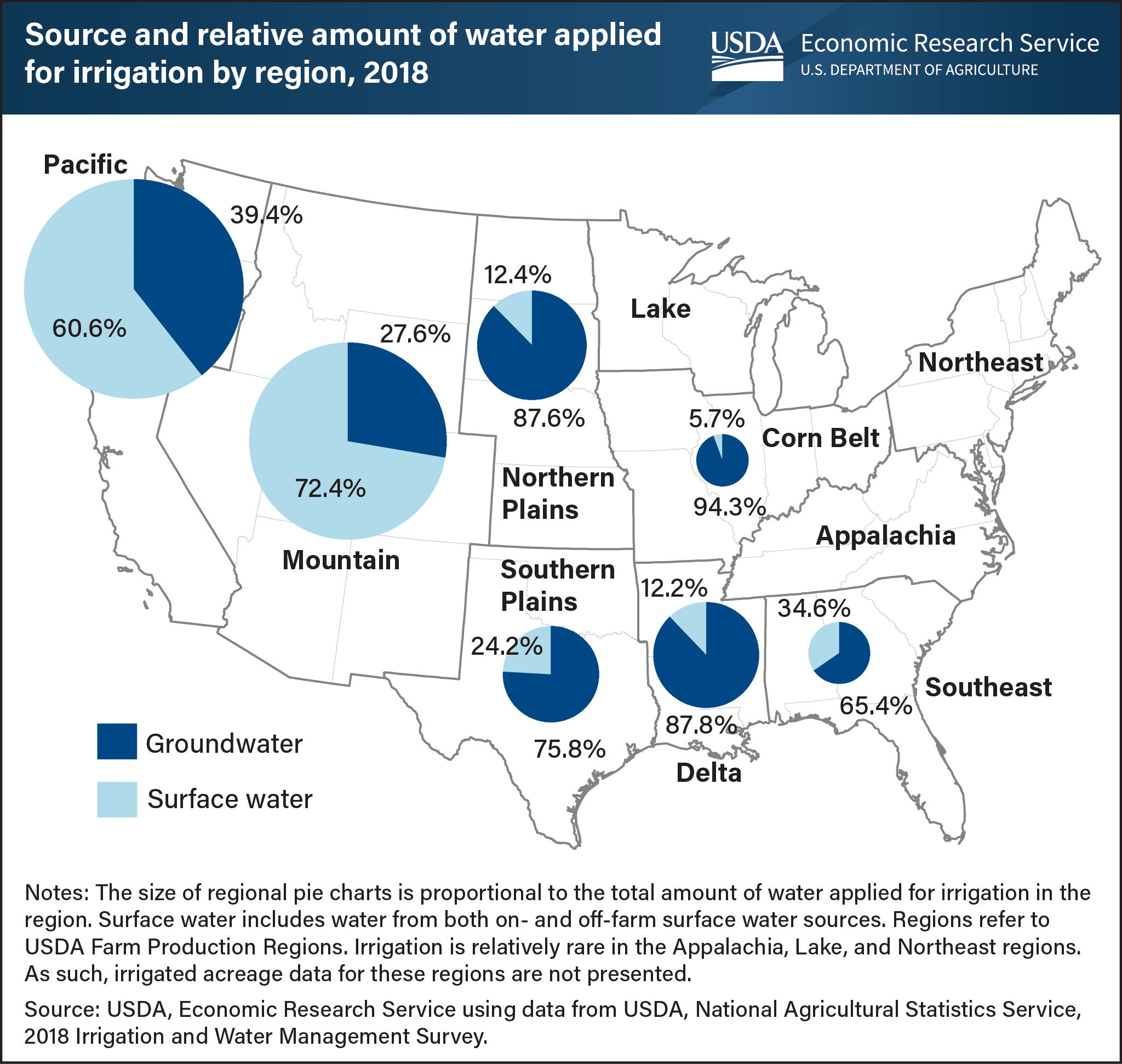
Surface and groundwater are the two primary water supply sources for irrigated agriculture. Groundwater is pumped from aquifers, while surface water is diverted from natural streams, rivers, and lakes. The predominance of surface versus groundwater use varies regionally. Groundwater is the most common source of water applied for irrigation in the Mississippi Delta, Northern Plains and Southern Plains regions. The prevalence of groundwater-fed irrigated agriculture in the Northern and Southern Plains relates to the regions’ historically abundant groundwater resources. The High Plains Aquifer, the largest aquifer in North America and also known as the Ogallala Aquifer, underlies significant portions of the Plains regions. The Mississippi Delta region also has abundant groundwater resources that are relatively shallow, making groundwater-based irrigation less expensive. Irrigated agriculture relying on surface water is most prevalent in the Mountain and Pacific regions. The extent of surface water use for irrigation in these regions reflects past Federal, State, and local investments in water conveyance and storage infrastructure, as well as characteristics of the regions’ legal institutions which grant water rights based on historical beneficial use rather than ownership of land along streams and rivers. This chart was drawn from the USDA, Economic Research Service report “Trends in U.S. Irrigated Agriculture: Increasing Resilience Under Water Supply Scarcity,” published December 28, 2021.